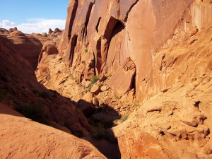
I received several questions on my Lake Powell blog so I figured I needed to follow it up with more details on the one aspect people seemed most interested in – our West Canyon hike. Lucky enough, my friends were up for the challenge again this year! Note that more pictures from this hike are in the West Canyon Hike Gallery. I’ve intentionally loaded low-res images on this blog so if you wants prints, pop me an email – don’t try printing from these please.
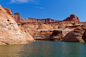
So, without further ado, here’s where we start from the main channel of Lake Powell (left). From here it’s a good 20-30 mins to the back of the canyon where you eventually park the boat. Of course this all depends on how high the water is, this year the water was pretty high. A couple years ago when we first did this hike, we had to park much further back and the hill at the end of the picture on the right was quite a climb. This year it was a piece of cake. Sign of things to come? Ahhhh, no – not really.
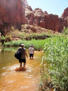
I said the water level was higher than normal and it showed from the beginning to the end of the hike. We had to wade and swim much more than a few years ago. Back then,
the initial hike was all sand and none of us remember this much vegitation. Still though, with the temperature around 90 degrees at the beginning of Sep, the water was welcome and refreshing.
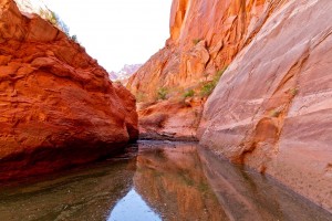
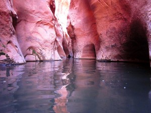
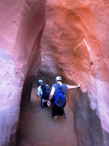
Here’s the first hint of what’s to come though. The first entrance into a slot. By the way, at this point I should mention that there are four of us on the expedition. I’m Chris, then there’s CBart, Vach and Dave. Our other regular participant on these trips is Schreck but he couldn’t make it this year. He was with us the first time we made this hike. You’ll be seeing a lot of us for the next several minutes. The last time we ventured here, we didn’t take a camera. I vo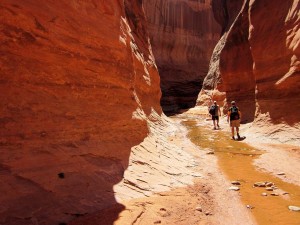 wed then that if we ever convinced ourselves to try this again, I’d definitely take a camera. I wasn’t able to take my Canon 7D but I was able to take our point and shoot which takes pretty nice pictures for a small camera. I had it in a waterproof case to protect it from the water and other hazards on that will soon become obvious.
Going through the first slots you find one of those hazards early on – algae covered rocks. With the water that doesn’t move much when it gets this low, algae grows and it’s tough to walk on but with a little care it doesn’t present much of a problem.
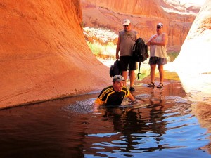
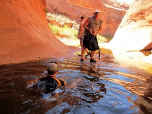
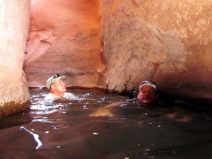
The pools in these canyons are sometimes deep but few were over our heads so again, with a little care they’re not a danger. You can walk around some of them but not all – some you have to wade or swim across. SO, let’s talk about the temperature of that water. How cold can it be when the air temperature has been 90s plus for months?
Luckily though, with good friends along for support, you can get through these feeling great about yourself. Supposedly, I uttered some high-pitched, not so manly curses as I crossed the pool. Clearly this is glacier melt although I’m not sure how the glaciers stay intact so close to Lake Powell. Oh, and check the other pictures in the gallery. They will show that my manly buddies here didn’t exactly enjoy this crossing either :).
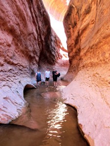
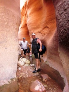
After navigating this icy pool, all’s well because there are more slot canyons to see! Honestly, when you see the other pictures in this series, there are some risky spots but even if you just go to Mushroom Rock (soon to come) it’s a great hike. It’s about 1 mile we guessed from where we park the boat to Mushroom Rock. The only real difficulties in this part of the hike are the freaking cold pools and slippery rocks. Sometime the path in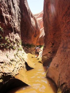 narrows to form a “V” at the bottom which makes the hiking a little tougher here (yeah, this is the case in the picture on the right).
The first mile into Mushroom takes about an hour if you take your time which we did. You could do it faster but not if you want to appreciate the awesome scenery which I highly recommend. While you see all this water, I’ll say that I doubt any of it’s safe to drink. Make sure if you take this hike, you bring lots of water to drink. You’ll need it. We didn’t take enough last time and it got close to being dangerous as a few of our group were severely dehydrated by the end. This time we hauled a couple packs that we shared carrying that were filled with bottled water and snacks. BIG improvement.
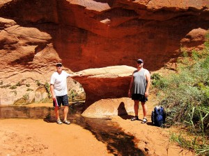
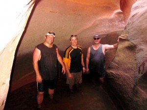
This is Mushroom Rock (modelled by Dave and Vach) which marks the starting point in the circle. You take a right from here and you’ll come back to this spot (via a 10 foot drop off). You could concievably go left I guess but I think it would be harder going that direction.
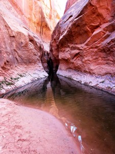
After heading right, the going gets more difficult. This starts pretty quickly with my favorite part of the whole trip – the swim channel. It’s hard to describe this and taking pictures is tough because it’s so dark. There also aren’t many places to rest as the water is very deep here. This section is so cool though. The start is pictured in the image to the right. The walls are narrow enough to touch both sides at the same time and the passage is filled with twists and turns. The water inside the slot is frigid (again!) but once you get in and start swimming, you get used to it. It’s probably around 100 yards in length but even so you’ll want to take advantage of the rocks that provide the rest areas because you’ll want to admire the environment. Those are nice places to take pictures too but the results will be mixed at best so take a lot of shots and expect to throw most away. Here are a few that were at least viewable.
I’ve occasionally tried to touch the bottom in this slot but have never been able to. Last year going through this section of the hike we found a large scorpion in the water. He’d obviously drowned fairly recently because his body was compeltely intact. Makes you think about where you put your hands!
As I said, I love this part of the trip. For some reason the combination of swimming and a beautiful slot canyon hits me just right. I wish I could show it better than this.
OK, soon after the swim channel, we’re off into the next slot. We were wet but undaunted. With the warm desert air, it doesn’t take long to dry off although there will be more opportunities to get wet on this hike. A few years ago this was the last real ground water that we saw until we got back to the lake. Not so this year.
But now we’re off hiking and climbing. Much of the slots from here until we start heading downhill are very narrow but the views are stunning. To the right here is a narrow right turn (can you see it?) where the wall colors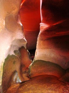 were just amazing. Oh and a little more water as you can see.
The good news is that the canyon walls are very high through much of this so even though it’s 90 or so out in the open, down in the slot it was pretty cool so the climbing isn’t as bad as it could be. This slot takes about 20 mins to traverse. There aren’t too many hazards here, just the occasional boulder to climb over that fell off the top of the canyon once upon a time and got pinned as the canyon narrowed at the bottom. Still, it does make you wonder what would happen if there was a stiff wind up top right NOW!
Here, the group stops for a rest and Dave takes a shot with the camera. You didn’t hear anyone complaining about rest stops even though at this point it hasn’t been too difficult. Don’t worry, it’s coming! Here’s is a section of the hike where we come out of the slot into the bright sunlight and have to make a not-to-obvious 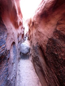 turn. Luckily, we were prepared this year as we’d already made the incorrect turn a few years ago :).
Speaking of rocks getting pinned after falling off the top of the canyon, to the right here’s the first obstacle after taking the *correct* turn. This doesn’t look like much but it was actually a little bit of a pain to get over. It was about 6 feet high and the rock was smooth so it was a great opportunity for a chimney climb (feet and back on opposite walls and skootching up slowly – yes, I’m pretty sure “skootching” is a technical climbers term. As you can tell by our physiques we’re all highly trained athletes . Up and over!
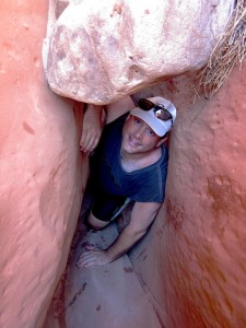 There are many tight places which, when combined with an uphill climb, can make for difficult spots. The sandstone is comprised of extremely fine sand which makes the wall smooth in many places so handholds are at a premium. Friends are a definite must on this hike for the occasional knee or hand or shoulder. Also, don’t forget to take your rope ladder. You’ll see the best reason for this soon.
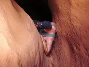
While hiking this path, sometimes it’s clear where the trail goes, other times you look around and all you can see exiting the area is a small drainage chute. Guess what? That’s the trail so you have to figure out a way up.
This is the kind amazing scenery you came for though so navigating each chute rewards you with the next awe inspiring channel. Make sure you take time to rest and enjoy the scenery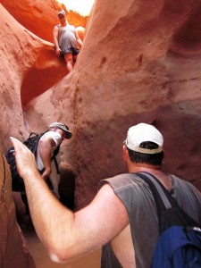 from time to time or you’ll be so caught up in making progress on the climb that you’ll forget why you’re really here. It would be a big disappointment to navigate your way through this hike only to look back and not be able to remember much of it.
God was on his game when he made this part of the country – it’s a shame more people don’t get to enjoy it.
A few years ago it was about here that we started getting a little worried about our water situation. It is hard work and you’ll burn a lot of calories. Making the journey ill prepared is a recipe for a dimished experience at best and potentially worse. We were lucky that first  time but we didn’t make the same mistake twice. The other thing that worried us after that first hike was the potential for injury. One broken ankle or tweaked back could make this… unpleasant. Come prepared.
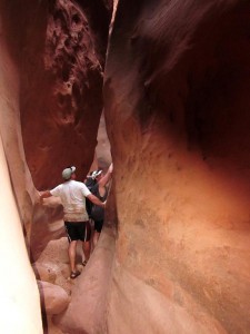
We’ve named this part of hike “The Chute”.
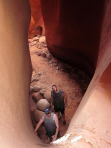
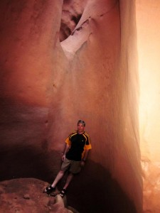
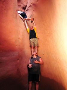
When we first came to The Chute a few years ago we were wondering if we’d made a wrong turn. We knew there was a significant cliff that we’d really need the rope ladder for but this looked higher than we’d expected and the exit chute looked so small! We decided to give it a shot and piled a good 400 pounds on CBart to get Dave over the top. Dave then held the ladder for me and then CBart and Vach took their turns. There were a few high fives when all four of us made it to the top :). Being a little more prepared for what we’d face this time made it a little easier to get up and over.
I’d like to say that once you make it over that beastly climb, the rest of the way is easy but that’s not the case. there are still several more challenging spots to go but we’re getting close. This spot (picture on the left) was a particular challenge not because the climb was that high (I think the top of the 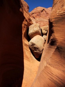 second rock there was about 10 feet off the floor) but both rocks had been baking in the sun the entire day and were really HOT!! We had to put one of the guy’s shirt on the rock just so we could place our arms and legs on it. You can probably tell by looking at that picture that the wall of this part of the slot are much lower though which is because we’re coming out of on top of the climb – at least as far as we go. There is more slot canyon to go after it
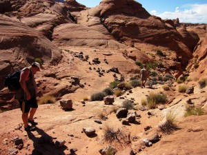 opens up here but we don’t know where that ends up as this is where we finally start to head back down to the lake.
One thing we thought was interesting here (right side) were all the random rocks strewn about. They look like they were placed by human beings rather than haphazardly dropped here by the weather. This is the hottest part of the entire trip.
This open chute include one nasty section that includes a hairly little blind drop that you just have to trust the landing will be where you expect it to be. Not too bad for normal people but we have two guys with bad knees and one guy with a bad back so that makes us even more tentative. But, we made it just fine.
The last real obstacle which I talked about earlier is the 10 foot (or so) drop off right before getting back to Mushroom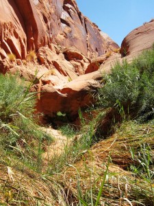 Rock. This really is not as big a deal as we made it but again, bad knees and backs made us cautious. The landing is pretty soft sand so jumping isn’t too bad.
So that brings us to the end of the circle or back to the beginning depending on how you want to look at it. We’re still about an hour away from the boat though but it’s a relatively easy hour walk back even though we were pretty tired by now. It’s a nice time to take a seat, drink some of the last of your water and talk about how cool the last few hours were. I hope you enjoyed this telling of our adventure. If you’re ever on the south end of Lake Powell and have a day to spend on an unforgettable hike, make sure you look into West Canyon!
